Topic
farming
179 record(s)
Type of resources
Available actions
Topics
INSPIRE themes
Keywords
Contact for the resource
Provided by
Years
Formats
Representation types
Update frequencies
Status
Scale
Resolution
geoDescCode
cartografia
geographicCoverage
geographicCoverageDesc
inspirecore
hvd
referenceDateRange
denominatorRange
resolutionRange
dataPolicy
openServiceType
dataType
dataFormat
-

Microbiological monitoring of bivalve mollusc production areas in mainland Portugal, since the year 2014, performed by quantification of Escherichia coli in meat and liquid intravalvular live bivalve, according to the sample planning. These analyzes are part of the National monitoring system of bivalve mollusc production areas and are considered in the classification of these areas and in the decision-making relative to their status. The data is collected according to the Regulation (EC) No 854/2004 of the European Parliament and of the Council of 29 April 2004 and the rules set out in Decree No. 1421/2006 of the Ministries of Economy and Innovation and Agriculture, Rural Development and Fisheries of 21 December 2006.
-
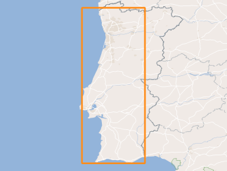
Identification and enumeration of harmful and potentially toxic phytoplankton species from water samples collected weekly in shellfish production areas, coastal and transition in mainland Portugal since the year 2014. These analyzes are part of the national system of monitoring bivalve mollusc production areas of IPMA and are considered in the zoning and in making decisions regarding their status. The data is collected for the requirements of Regulation (EC) No 854/2004 of the European Parliament and of the Council of 29 April 2004.
-
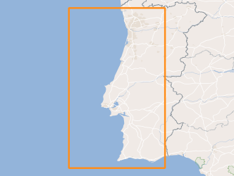
Within Portugal's National Biological Sampling Project (PNAB) a set of activities are conducted in the collection, management and use of biological data, collected from the registered commercial fleet in mainland Portugal (fisheries-dependent data) and several research surveys (independent fisheries data). These activities allow the assessment of the state of fishery resources, population structure, distribution and abundance of resources, diversity and dynamics of biological communities associated with the fishery resources and biological studies (growth, reproduction).Demersal autumn campaigns are usually held in September/October with the ship “Noruega” and cover the full extent of the Portuguese coast (between Caminha and Vila Real Sto António).
-
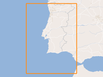
Within Portugal's National Biological Sampling Project (PNAB) a set of activities are conducted in the collection, management and use of biological data, collected from the registered commercial fleet in mainland Portugal (fisheries-dependent data) and several research surveys (independent fisheries data). These activities allow the assessment of the state of fishery resources, population structure, distribution and abundance of resources, diversity and dynamics of biological communities associated with the fishery resources and biological studies (growth, reproduction).The spring acoustic surveys are usually held in April/May with the ship "Noruega" and cover the Portuguese continental waters and the Spanish waters of the Gulf of Cadiz, between 20 and 200m deep.
-
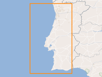
Within Portugal's National Biological Sampling Project (PNAB) a set of activities are conducted in the collection, management and use of biological data, collected from the registered commercial fleet in mainland Portugal (fisheries-dependent data) and several research surveys (independent fisheries data). These activities allow the assessment of the state of fishery resources, population structure, distribution and abundance of resources, diversity and dynamics of biological communities associated with the fishery resources and biological studies (growth, reproduction).Demersal autumn campaigns are usually held in September/October with the ship “Noruega” and cover the full extent of the Portuguese coast (between Caminha and Vila Real Sto António).
-
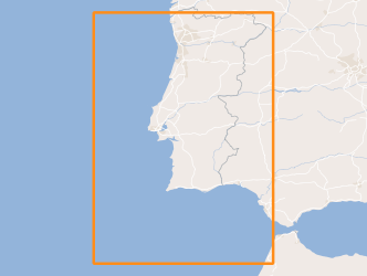
Within Portugal's National Biological Sampling Project (PNAB) a set of activities are conducted in the collection, management and use of biological data, collected from the registered commercial fleet in mainland Portugal (fisheries-dependent data) and several research surveys (independent fisheries data). These activities allow the assessment of the state of fishery resources, population structure, distribution and abundance of resources, diversity and dynamics of biological communities associated with the fishery resources and biological studies (growth, reproduction).The spring acoustic surveys are usually held in April/May with the ship "Noruega" and cover the Portuguese continental waters and the Spanish waters of the Gulf of Cadiz, between 20 and 200m deep.
-
Within Portugal's National Biological Sampling Project (PNAB) a set of activities are conducted in the collection, management and use of biological data, collected from the registered commercial fleet in mainland Portugal (fisheries-dependent data) and several research surveys (independent fisheries data). These activities allow the assessment of the state of fishery resources, population structure, distribution and abundance of resources, diversity and dynamics of biological communities associated with the fishery resources and biological studies (growth, reproduction).This resource shows the geographic distribution of arrow shrimp abundancy index (nr. individuals/hour) registered during the CRUSTACEOS2010 campaign in June 2010.
-
Within Portugal's National Biological Sampling Project (PNAB) a set of activities are conducted in the collection, management and use of biological data, collected from the registered commercial fleet in mainland Portugal (fisheries-dependent data) and several research surveys (independent fisheries data). These activities allow the assessment of the state of fishery resources, population structure, distribution and abundance of resources, diversity and dynamics of biological communities associated with the fishery resources and biological studies (growth, reproduction).This resource shows the geographic distribution of small-spotted catshark abundancy index (nr. individuals/hour) registered during the CRUSTACEOS2013 campaign in June 2013.
-
Within Portugal's National Biological Sampling Project (PNAB) a set of activities are conducted in the collection, management and use of biological data, collected from the registered commercial fleet in mainland Portugal (fisheries-dependent data) and several research surveys (independent fisheries data). These activities allow the assessment of the state of fishery resources, population structure, distribution and abundance of resources, diversity and dynamics of biological communities associated with the fishery resources and biological studies (growth, reproduction).This resource shows the geographic distribution of european hake abundancy index (nr. individuals/hour) registered during the CRUSTACEOS2014 campaign in June 2014.
-
Within Portugal's National Biological Sampling Project (PNAB) a set of activities are conducted in the collection, management and use of biological data, collected from the registered commercial fleet in mainland Portugal (fisheries-dependent data) and several research surveys (independent fisheries data). These activities allow the assessment of the state of fishery resources, population structure, distribution and abundance of resources, diversity and dynamics of biological communities associated with the fishery resources and biological studies (growth, reproduction). This resource shows the geographic distribution of european hake abundancy index (nr. individuals/hour) registered during the CRUSTACEOS2010 campaign in June 2010.
