
Keyword
Oceans
135 record(s)
Type of resources
Topics
INSPIRE themes
Keywords
Provided by
Representation types
Update frequencies
Status
Scale
-

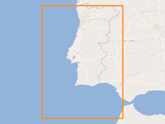
Within Portugal's National Biological Sampling Project (PNAB) a set of activities are conducted in the collection, management and use of biological data, collected from the registered commercial fleet in mainland Portugal (fisheries-dependent data) and several research surveys (independent fisheries data). These activities allow the assessment of the state of fishery resources, population structure, distribution and abundance of resources, diversity and dynamics of biological communities associated with the fishery resources and biological studies (growth, reproduction).This resource shows the geographic distribution of blue and red shrimp abundancy index (nr. individuals/hour) registered during the CRUSTACEOS2013 campaign in June 2013.
-
Within Portugal's National Biological Sampling Project (PNAB) a set of activities are conducted in the collection, management and use of biological data, collected from the registered commercial fleet in mainland Portugal (fisheries-dependent data) and several research surveys (independent fisheries data). These activities allow the assessment of the state of fishery resources, population structure, distribution and abundance of resources, diversity and dynamics of biological communities associated with the fishery resources and biological studies (growth, reproduction). This resource shows the geographic distribution of atlantic mackerel abundancy index (nr. individuals/hour) registered during the PELAGO08 acoustic campaign in April 2008.
-
Within Portugal's National Biological Sampling Project (PNAB) a set of activities are conducted in the collection, management and use of biological data, collected from the registered commercial fleet in mainland Portugal (fisheries-dependent data) and several research surveys (independent fisheries data). These activities allow the assessment of the state of fishery resources, population structure, distribution and abundance of resources, diversity and dynamics of biological communities associated with the fishery resources and biological studies (growth, reproduction).This resource shows the geographic distribution of atlantic mackerel abundancy index (nr. individuals/hour) registered during the DEMERSAL2008 campaign in September 2008.
-

Within Portugal's National Biological Sampling Project (PNAB) a set of activities are conducted in the collection, management and use of biological data, collected from the registered commercial fleet in mainland Portugal (fisheries-dependent data) and several research surveys (independent fisheries data). These activities allow the assessment of the state of fishery resources, population structure, distribution and abundance of resources, diversity and dynamics of biological communities associated with the fishery resources and biological studies (growth, reproduction). This resource shows the geographic distribution of bogue abundancy index (nr. individuals/hour) registered during the PELAGO08 acoustic campaign in April 2008.
-
The current artificial reefs were deployed, starting with a pilot project in 1990, in order to serve as instrument for the revitalization of coastal ecosystems, planning of coastal fisheries and integrated coastal zone management. Each reef is composed by, at least, 2940 concrete modules with a weight of 3 tons and 36 large modules with more than 40 tons each. The reef complex groups 20,748 modules (with a total volume of over 100,000 m3), occupying discontinuously a total area of approximately 43.5 km2, with an area of influence greater than 67 km2.
-

Within Portugal's National Biological Sampling Project (PNAB) a set of activities are conducted in the collection, management and use of biological data, collected from the registered commercial fleet in mainland Portugal (fisheries-dependent data) and several research surveys (independent fisheries data). These activities allow the assessment of the state of fishery resources, population structure, distribution and abundance of resources, diversity and dynamics of biological communities associated with the fishery resources and biological studies (growth, reproduction).This resource shows the geographic distribution of blue whiting abundancy index (nr. individuals/hour) registered during the CRUSTACEOS2008 campaign in June 2008.
-
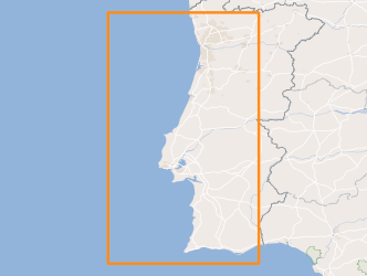
Within Portugal's National Biological Sampling Project (PNAB) a set of activities are conducted in the collection, management and use of biological data, collected from the registered commercial fleet in mainland Portugal (fisheries-dependent data) and several research surveys (independent fisheries data). These activities allow the assessment of the state of fishery resources, population structure, distribution and abundance of resources, diversity and dynamics of biological communities associated with the fishery resources and biological studies (growth, reproduction).The crustaceans campaigns are usually held in June/July with the ship “Noruega” and cover the extension of the Portuguese coast of Alentejo and Algarve.
-
This project aims to characterize the evolution of the coastline during the Quaternary and discern what were the contributions to this evolution: 1) neotectonic, 2) eustatic variations and 3) sedimentary transport; for this purpose was selected as study area the coastal stretch between Cabo da Roca (~ 38 46'N) and the village of Comporta (~ 38 20'N).
-

Within Portugal's National Biological Sampling Project (PNAB) a set of activities are conducted in the collection, management and use of biological data, collected from the registered commercial fleet in mainland Portugal (fisheries-dependent data) and several research surveys (independent fisheries data). These activities allow the assessment of the state of fishery resources, population structure, distribution and abundance of resources, diversity and dynamics of biological communities associated with the fishery resources and biological studies (growth, reproduction). This resource shows the geographic distribution of deep-water rose shrimp abundancy index (nr. individuals/hour) registered during the CRUSTACEOS2010 campaign in June 2010.
-

Within Portugal's National Biological Sampling Project (PNAB) a set of activities are conducted in the collection, management and use of biological data, collected from the registered commercial fleet in mainland Portugal (fisheries-dependent data) and several research surveys (independent fisheries data). These activities allow the assessment of the state of fishery resources, population structure, distribution and abundance of resources, diversity and dynamics of biological communities associated with the fishery resources and biological studies (growth, reproduction).This resource shows the geographic distribution of blue and red shrimp abundancy index (nr. individuals/hour) registered during the CRUSTACEOS2014 campaign in June 2014.