
Type
series
1831 record(s)
Type of resources
Available actions
Topics
INSPIRE themes
Keywords
Contact for the resource
Provided by
Years
Formats
Representation types
Update frequencies
Status
Scale
Resolution
geoDescCode
cartografia
geographicCoverage
geographicCoverageDesc
inspirecore
referenceDateRange
denominatorRange
resolutionRange
dataPolicy
openServiceType
dataType
dataFormat
-
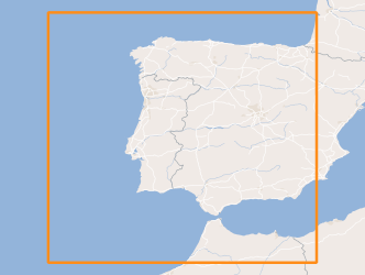
Within Portugal's National Biological Sampling Project (PNAB) a set of activities are conducted in the collection, management and use of biological data, collected from the registered commercial fleet in mainland Portugal (fisheries-dependent data) and several research surveys (independent fisheries data). These activities allow the assessment of the state of fishery resources, population structure, distribution and abundance of resources, diversity and dynamics of biological communities associated with the fishery resources and biological studies (growth, reproduction).The spring acoustic surveys are usually held in April/May with the ship "Noruega" and cover the Portuguese continental waters and the Spanish waters of the Gulf of Cadiz, between 20 and 200m deep.
-

Three-hourly forecast maps of accumulated precipitation in mm/3h in the Atlantic region, generated from ECMWF data twice a day, at 00UTC and 12UTC, with forecasts every 3 hours of the current day from 00h to the next 120 hours.
-

Within Portugal's National Biological Sampling Project (PNAB) a set of activities are conducted in the collection, management and use of biological data, collected from the registered commercial fleet in mainland Portugal (fisheries-dependent data) and several research surveys (independent fisheries data). These activities allow the assessment of the state of fishery resources, population structure, distribution and abundance of resources, diversity and dynamics of biological communities associated with the fishery resources and biological studies (growth, reproduction).The crustaceans campaigns are usually held in June/July with the ship “Noruega” and cover the extension of the Portuguese coast of Alentejo and Algarve.
-
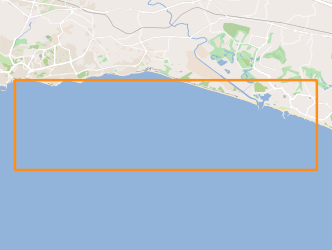
The FREEZE 2010 geophysical cruise was planned to acquire a detailed bathymetry just off Olhos d'Agua, high resolution seismic and Side Scan Sonar data in order to investigate and define the geological and the tectonic settings off Olhos d'Agua (Algarve coast, South Portugal) and to find any possible evidence of supposed existing submarine groundwater discharges (SGDs) in this area.
-

Within Portugal's National Biological Sampling Project (PNAB) a set of activities are conducted in the collection, management and use of biological data, collected from the registered commercial fleet in mainland Portugal (fisheries-dependent data) and several research surveys (independent fisheries data). These activities allow the assessment of the state of fishery resources, population structure, distribution and abundance of resources, diversity and dynamics of biological communities associated with the fishery resources and biological studies (growth, reproduction).The crustaceans campaigns are usually held in June/July with the ship “Noruega” and cover the extension of the Portuguese coast of Alentejo and Algarve.
-
Three-hourly forecast maps of mean sea level pressure in Pascal in the Atlantic region, generated from ECMWF data twice a day, at 00UTC and 12UTC, with forecasts every 3 hours of the current day from 00h to the next 120 hours.
-
Three-hourly forecast maps of accumulated precipitation in mm/3h for the Iberian Peninsula, generated with the AROME model. The maps are generated twice a day, at 00UTC and 12UTC, with forecasts of the following 48 hours.
-

Three-hourly forecast maps of air temperature at 2 meters in Kelvin for the Iberian Peninsula, generated with the AROME model. The maps are generated twice a day, at 00UTC and 12UTC, with forecasts of the following 48 hours.
-

Ocean thermal fronts are produced daily "detected" with the SIED algorithm - Single Image Edge Detection (Cayula and Cornillon, 1992) applied to satellite images of the sea surface temperature (SST), made available by the CMEMS (Copernicus Marine Environment Monitoring Service) and DEIMOS, is run by Meteo France CMS over EUROPE.
-
Within Portugal's National Biological Sampling Project (PNAB) a set of activities are conducted in the collection, management and use of biological data, collected from the registered commercial fleet in mainland Portugal (fisheries-dependent data) and several research surveys (independent fisheries data). These activities allow the assessment of the state of fishery resources, population structure, distribution and abundance of resources, diversity and dynamics of biological communities associated with the fishery resources and biological studies (growth, reproduction).The crustaceans campaigns are usually held in June/July with the ship “Noruega” and cover the extension of the Portuguese coast of Alentejo and Algarve.