
Format
SEGY
6 record(s)
Type of resources
INSPIRE themes
Provided by
Years
Formats
Representation types
Update frequencies
Scale
geoDescCode
cartografia
geographicCoverage
geographicCoverageDesc
referenceDateRange
denominatorRange
resolutionRange
dataPolicy
openServiceType
dataType
dataFormat
-

The TOPOMED-FREEZE campaign was organized as a joint campaign of the TOPOMED and FREEZE projects sponsored by the Fundação para a Ciência e a Tecnologia (FCT) (Plate reorganization in the western Mediterranean: lithospheric causes and topographic consequences, TOPOEUROPE/0001/2007; Submarine FREshwater dischargEs: characteriZation and Evaluation study on their impact on the Algarve coastal ecosystems, PTDC/MAR/102030/2008). These two projects share complementary study areas and objectives. The first concentrates on the effects of neotectonics on the evolution of landscape and environments and the second on the investigation of Submarine Fresh-Water Discharges.
-
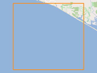
A campanha sísmica ASTARTE 2014 tem como objetivo estender a área de levantamentos sísmicos anteriores até a uma distância de cerca de 20 milhas náuticas a partir da costa até a borda da plataforma continental. O planeamento da campanha contempla a aquisição de 24 perfis divididos em duas classes: uma classe em linha perpendicular à costa e uma classe em linha cruzada ortogonal às anteriores. A principal razão para selecionar a região ao largo da Quarteira é porque esta região é um alvo de registos de tsunamis na plataforma continental, embora toda a costa do Algarve possa ser um repositório de registros geológicos de tsunamis passados.
-
This project aims to characterize the evolution of the coastline during the Quaternary and discern what were the contributions to this evolution: 1) neotectonic, 2) eustatic variations and 3) sedimentary transport; for this purpose was selected as study area the coastal stretch between Cabo da Roca (~ 38 46'N) and the village of Comporta (~ 38 20'N).
-
The FREEZE 2010 geophysical cruise was planned to acquire a detailed bathymetry just off Olhos d'Agua, high resolution seismic and Side Scan Sonar data in order to investigate and define the geological and the tectonic settings off Olhos d'Agua (Algarve coast, South Portugal) and to find any possible evidence of supposed existing submarine groundwater discharges (SGDs) in this area.
-
The Tagusdelta campaign had technical and scientific objectives. The main technical objective was to make the proof of concept of the new proposed method for the acquisition of 3D very high resolution seismic reflection data. The accomplishment of this objective included: deployment and data acquisition systems tests; positioning uncertainty assessment; seismic and positioning data processing for the 3D seismic volume generation. From the scientific point of view the main objective was to acquire very high resolution seismic reflection data that allow the characterization of the frontal area of the Tagus ebb-tide delta seismic stratigraphic facies arquitecture. A special focus was placed in the: identification, characterization and mapping of mass wasting features, in order to allow a first trial of the Pleisto-Holocene mapping and chronostratigraphy of these features in the Tagus delta; imaging the morphologies of landslide structures with 3D seismic, particularly in what concerns the landslide already identified with the previous data, to allow the quantification and precise location of the events, to generate data of unprecedented realism that can be fed into the tsunamigenic mathematical models.
-
The ERSTA project intended to study the seismogenic and tsunamigenic bodies and prepare an sismotectonic model for the Algarve region. For this project, in this campaign, was intend to carry out a geophysical survey that will contribute to a more detailed characterization, in the offshore region, of São Marcos-Quarteira and Carcavai faults. The SANDEX project aims to evaluate the physical impact from the extraction of sand and gravel in the coastal sediment balance and evolution of the coastline. The campaign aims to collect bathymetric data that will contribute to monitoring of the impact caused by the exploitation of sand deposits carried off the Quarteira as well as for the assessment of sediment budget of the study area.