Creation year
2012
35 record(s)
Type of resources
Available actions
INSPIRE themes
Provided by
Years
Formats
Representation types
Update frequencies
Status
Scale
Resolution
geoDescCode
cartografia
geographicCoverage
geographicCoverageDesc
inspirecore
hvd
referenceDateRange
denominatorRange
resolutionRange
dataPolicy
openServiceType
dataType
dataFormat
-

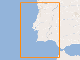
Within Portugal's National Biological Sampling Project (PNAB) a set of activities are conducted in the collection, management and use of biological data, collected from the registered commercial fleet in mainland Portugal (fisheries-dependent data) and several research surveys (independent fisheries data). These activities allow the assessment of the state of fishery resources, population structure, distribution and abundance of resources, diversity and dynamics of biological communities associated with the fishery resources and biological studies (growth, reproduction).The spring acoustic surveys are usually held in April/May with the ship "Noruega" and cover the Portuguese continental waters and the Spanish waters of the Gulf of Cadiz, between 20 and 200m deep.
-
Planta de Condicionantes da Revisão do Plano Director Municipal de Nordeste, publicado através do Aviso n.º 1724/2013, de 4 de Fevereiro.
-
Cartografia à escala 1:5000 para a elaboração de quatro Planos de Pormenor para o Vale da Telha no concelho de Aljezur. Para a aquisição da cartografia vetorial o sistema de referência utilizado foi o ETRS89-TM06.
-

Within Portugal's National Biological Sampling Project (PNAB) a set of activities are conducted in the collection, management and use of biological data, collected from the registered commercial fleet in mainland Portugal (fisheries-dependent data) and several research surveys (independent fisheries data). These activities allow the assessment of the state of fishery resources, population structure, distribution and abundance of resources, diversity and dynamics of biological communities associated with the fishery resources and biological studies (growth, reproduction).This resource shows the geographic distribution of european hake abundancy index (nr. individuals/hour) registered during the CRUSTACEOS2011 campaign in June 2011.
-

Within Portugal's National Biological Sampling Project (PNAB) a set of activities are conducted in the collection, management and use of biological data, collected from the registered commercial fleet in mainland Portugal (fisheries-dependent data) and several research surveys (independent fisheries data). These activities allow the assessment of the state of fishery resources, population structure, distribution and abundance of resources, diversity and dynamics of biological communities associated with the fishery resources and biological studies (growth, reproduction).This resource shows the geographic distribution of arrow shrimp abundancy index (nr. individuals/hour) registered during the CRUSTACEOS2011 campaign in June 2011.
-
Modelo Digital do Terreno do Município de Paredes executado a partir de uma cobertura aerofotogramétrica com resolução espacial de 10 cm (GSD). Resolução espectral 4 bandas (RGB e NIR) e resolução radiométrica de 16 bits. Este Modelo Digital do Terreno é composto por 204 ficheiros de 1 km x 1 km, sobreposição, nas direcções E-O e N-S, respetivamente.
-
Cartografia Topográfica de Imagem homologada: Núcleos urbanos dos concelhos de Alcácer do Sal, Grândola, Odemira, Santiago do Cacém e Sines
-
Georreferenciação dos limites do Parque Natural de Ilha de Santa Maria. Inclui informação do SITE_CODE_NAT, Designação, CAT_PNI, Diploma, CAT_IUCN, Area_HA, freguesias e concelhos onde se insere. O Parque Natural de Ilha de Santa Maria foi criado pelo Decreto Legislativo Regional n.º 47/2008/A, de 7 de novembro, alterado pelo Decreto Legislativo Regional n.º 39/2012/A, de 19 de setembro e integra a Reserva Natural dos Ilhéus das Formigas, a Reserva Natural do Ilhéu da Vila, o Monumento Natural da Pedreira do Campo, do Figueiral e Prainha, a Área Protegida para a Gestão de Habitats ou Espécies da Costa Sudoeste, a Área Protegida para a Gestão de Habitats ou Espécies da Ponta do Castelo, a Área Protegida para a Gestão de Habitats ou Espécies da Baía do Cura, a Área Protegida para a Gestão de Habitats ou Espécies do Pico Alto, a Área de Paisagem Protegida do Barreiro da Faneca, a Área de Paisagem Protegida da Baíade São Lourenço, a Área de Paisagem Protegida da Baía da Maia, a Área Protegida de Gestão de Recursos da Baía de São Lourenço, a Área Protegida de Gestão de Recursos da Costa Nortee aÁrea Protegida de Gestão de Recursos da Costa Sul. Os dados geográficos foram obtidos com base nos elementos da Carta Militar de Portugal 1:25 000 (edição 2000, série M889) produzida pelo Instituto Geográfico do Exército.
-
Levantamento dos hidrantes em abril de 2012, no âmbito do Projeto BomberGIS - Serviço Regional de Proteção Civil e Bombeiros dos Açores
-

Within Portugal's National Biological Sampling Project (PNAB) a set of activities are conducted in the collection, management and use of biological data, collected from the registered commercial fleet in mainland Portugal (fisheries-dependent data) and several research surveys (independent fisheries data). These activities allow the assessment of the state of fishery resources, population structure, distribution and abundance of resources, diversity and dynamics of biological communities associated with the fishery resources and biological studies (growth, reproduction).This resource shows the geographic distribution of Norway lobster abundancy index (nr. individuals/hour) registered during the CRUSTACEOS2011 campaign in June 2011.
