
Creation year
2017
88 record(s)
Type of resources
Available actions
INSPIRE themes
Provided by
Years
Formats
Representation types
Update frequencies
Service types
Scale
Resolution
geoDescCode
cartografia
geographicCoverage
geographicCoverageDesc
inspirecore
hvd
referenceDateRange
denominatorRange
resolutionRange
dataPolicy
openServiceType
dataType
dataFormat
-
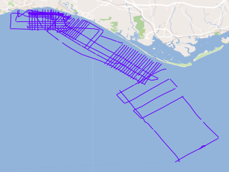
Joint campaigns of the TOPOMED and FREEZE projects sponsored by the Portuguese Foundation for Science and Technology (FCT). These two projects share complementary and objective areas of study. The first focuses on the effects of neotectonics on the evolution of landscape and environments and the second on the investigation of underwater discharges of fresh water.
-

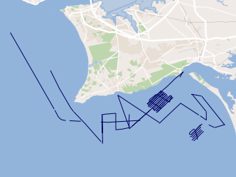
Joint campaigns of the ERSTA and SANDEX projects, the ERSTA project is designed to study seismogenic and tsunamigenic bodies and to prepare a seismotectonic model for the Algarve region, the SANDEX project aims to evaluate the physical impact of sand and gravel extraction on the sedimentary balance and the evolution of the coastline.
-
This project aims to characterize the evolution of the coastline during the Quaternary and discern what were the contributions to this evolution: 1) neotectonic, 2) eustatic variations and 3) sedimentary transport.
-
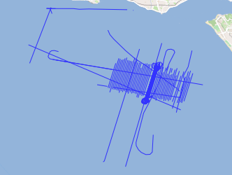
TAGUSDELTA geophysical campaigns aim to collect the necessary information to elaborate the high resolution 3D seismic stratigraphy of the Tagus Delta.
-

Ocean thermal fronts are produced daily "detected" with the SIED algorithm - Single Image Edge Detection (Cayula and Cornillon, 1992) applied to satellite images of the sea surface temperature (SST), made available by the CMEMS (Copernicus Marine Environment Monitoring Service) and DEIMOS, is run by Meteo France CMS over EUROPE.
-
Geological map data of Spain and Portugal at 1:1 000 000 scale modified according to INSPIRE data specifications for the Geology theme. Layers depicting Geologic Units are classified according to ages and lithologies from INSPIRE vocabularies.
-
Ocean thermal fronts are produced daily "detected" with the SIED algorithm - Single Image Edge Detection (Cayula and Cornillon, 1992) applied of the sea surface temperature in the HYCOM model (HYbrid Coordinate Ocean Model) available at DEIMOS and provided / supplies by IH.
-

Notifications concerning marine casualties and marine incidents occurring in the Portuguese territorial waters and in internal waters and with Portuguese flaged vessels in any part of the world.
-
Viewing Service according to the INSPIRE profile (ISO19128-WMS 1.3.0), from the location limits used for the issuance of Meteorological Forecast Reports for Maritime Navigation in the areas of sea of national responsibility (Mainland Portugal, Azores and Madeira), inserted mainly in METAREA II, according to the standards defined by the Global Maritime Distress and Safety System (GMDSS).
-
Notifications concerning marine casualties and marine incidents occurring in the Portuguese territorial waters and in internal waters and with Portuguese flaged vessels in any part of the world.