
Keyword
Habitats e biótopos
13 record(s)
Type of resources
Available actions
INSPIRE themes
Provided by
Years
Formats
Representation types
Update frequencies
Status
Scale
Resolution
geoDescCode
cartografia
geographicCoverage
geographicCoverageDesc
inspirecore
hvd
referenceDateRange
denominatorRange
resolutionRange
dataPolicy
openServiceType
dataType
dataFormat
-
The Nazaré Artificial Reef deployed in 2010, covering an area of apr. 3 Km2 was a public project commissioned by the Nazaré Council, with the technical and scientific support of the multidisplinary research team from IPMA.
-
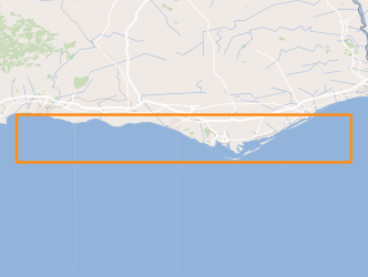
The current artificial reefs were deployed, starting with a pilot project in 1990, in order to serve as instrument for the revitalization of coastal ecosystems, planning of coastal fisheries and integrated coastal zone management. Each reef is composed by, at least, 2940 concrete modules with a weight of 3 tons and 36 large modules with more than 40 tons each. The reef complex groups 20,748 modules (with a total volume of over 100,000 m3), occupying discontinuously a total area of approximately 43.5 km2, with an area of influence greater than 67 km2.
-
O CDG contém a cartografia de habitats naturais e seminaturais de 31 Zonas Especiais de Conservação: Barrinha de Esmoriz; Barrocal; Cabeção; Cabrela; Caia; Caldeirão; Cambarinho; Carregal do Sal; Cerro da Cabeça; Estuário do Sado; Estuário do Tejo; Fernão Ferro/Lagoa de Albufeira; Malcata; Minas de Stº Adrião; Monchique; Monfurado; Morais; Moura/Barrancos; Nisa/Laje da Prata; Paul de Arzila; Ria de Alvor; Ria de Aveiro; Ria Formosa/Castro Marim; Romeu; Samil; São Mamede; Serra da Gardunha; Serra da Lousã; Serra de Montejunto; Serras de Aire e Candeeiros; Sicó/Alvaiázere. A tabela de atributos da shapefile contém os seguintes campos: • CodSitio - Código da ZEC • Sitio_Nome – Nome da ZEC • Habitats - Códigos de todos os habitats identificados no polígono, por ordem decrescente do grau de cobertura, num máximo de 3 habitats • H1_Cod - Código do habitat 1 • H1_Nome – Nome habitat 1 • H1_Cobert - Grau de cobertura do habitat 1 • H2_Cod - Código do habitat 2 • H2_Nome – Nome habitat 2 • H2_Cobert - Grau de cobertura do habitat 2 • H3_Cod - Código do habitat 3 • H3_Nome – Nome habitat 3 • H3_Cobert - Grau de cobertura do habitat 3 • Fonte - Entidade produtora da informação • Esc_origem - Escala de origem da informação Códigos de preenchimento do campo H-cobert: Classes de cobertura: A - >75%; B – 30-75%; C - 0-30%
-
O presente Conjunto de Dados Geográficos (CDG) contém cerca de 48.000 registos de ocorrência de espécies da flora vascular em Portugal Continental. Não se trata de informação exaustiva relativa a todas as espécies da flora vascular de Portugal continental (que ultrapassa os 3000 taxa), mas sim de uma compilação da informação existente relativa a um grupo de 630 taxa alvo do projeto, selecionados com base na sua relevância científica e conservacionista, para os quais foi recolhida informação e posteriormente foi avaliado o risco de extinção de acordo com os critérios da UICN (União Internacional para a Conservação da Natureza).
-
Mapeamento digital do habitat prioritário sebas (ervas marinhas – subtipos 1110pt2, 1110pt3 e 1110pt4 do habitat 1110 da Rede Natura 2000) do estuário do Sado, realizado no âmbito do projeto ORTOSado-2021 a partir de ortofotomapas RGBi de 0,2 x 0,2 m de pixel, produzidos pela Municipia S.A. nos dias 7 e 8 de outubro de 2021.
-
Espécies da fauna, flora e aves do Plano Setorial da Rede Natura 2000 (PSRN2000)
-
Distribuição dos habitats protegidos pela Diretiva Habitats para Portugal Continental. Informação obtida através dos trabalhos desenvolvidos no âmbito do Relatório Nacional de Implementação da Diretiva Habitats (2007-2012) e (2013-2018).
-
Tipos de habitats naturais de interesse comunitário constantes do Anexo I da Diretiva Habitats
-
Distribuição dos Habitats protegidos pela Diretiva Habitats para o arquipélago dos Açores. Informação obtida através dos trabalhos desenvolvidos no âmbito do Relatório Nacional de Implementação da Diretiva Habitats (2001-2006). Dados da responsabilidade da Secretaria Regional do Ambiente e Ação Climática/Governo dos Açores em parceria com o Instituto da Conservação da Natureza e da Biodiversidade. Este conjunto de dados integra os Conjuntos de Dados de Elevado Valor/HVD identificados de acordo com o Regulamento de Execução n.º 2023/138 da Diretiva (UE) 2019/1024, relativa aos dados abertos e à reutilização de informações do setor público.
-
Distribuição dos habitats protegidos pela Diretiva Habitats para o arquipélago dos Açores. Informação obtida através dos trabalhos desenvolvidos no âmbito do Relatório Nacional de Implementação da Diretiva Habitats (2007-2012). Dados da responsabilidade da Secretaria Regional do Ambiente e Ação Climática/Governo dos Açores em parceria com o Instituto da Conservação da Natureza e das Florestas. Este conjunto de dados integra os Conjuntos de Dados de Elevado Valor/HVD identificados de acordo com o Regulamento de Execução n.º 2023/138 da Diretiva (UE) 2019/1024, relativa aos dados abertos e à reutilização de informações do setor público.