
Keyword
Batimetria e Geomorfologia Marinha
9 record(s)
Type of resources
Available actions
INSPIRE themes
Provided by
Years
Formats
Representation types
Update frequencies
Scale
geoDescCode
cartografia
geographicCoverage
geographicCoverageDesc
inspirecore
hvd
referenceDateRange
denominatorRange
resolutionRange
dataPolicy
openServiceType
dataType
dataFormat
-

Geology and Geomorphology of offshore Portugal in the Quaternary period, using as reference the Geological Chart of the Immersed Area, Scale 1: 2 000 000, of the Geological Chart of Portugal, Scale 1: 1 000 000. National Laboratory of Energy and Geology (LNEG) 2010 .
-
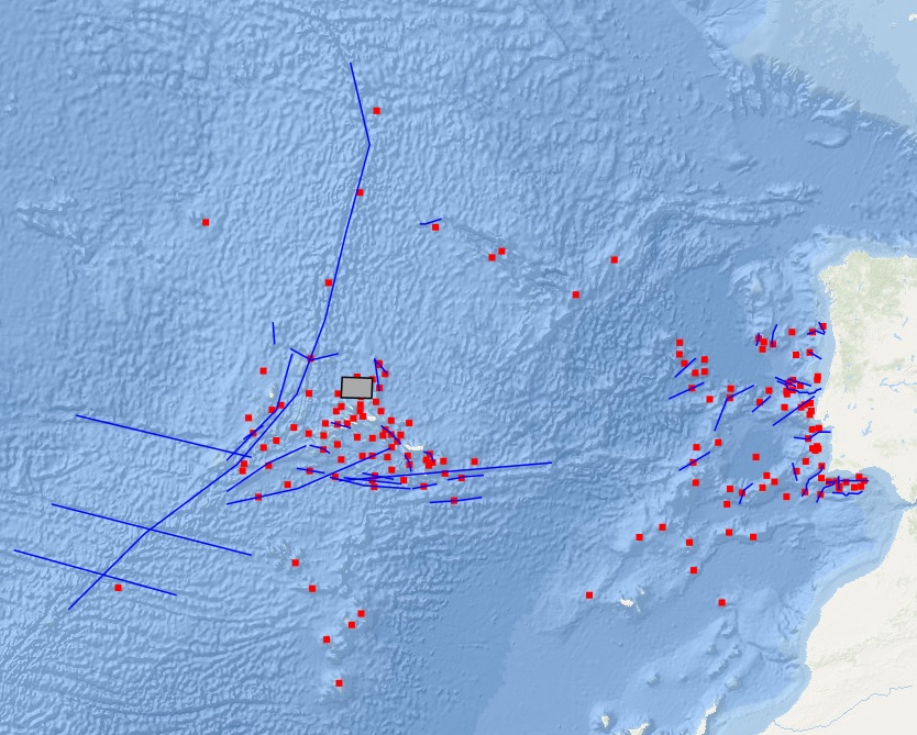
Location of structures resulting from the submarine fluids emissions, such as: mud volcanoes (methane hydrates); Pockmaks (methane) and hydrothermal vents (fluids enriched in salts and metallic elements), located between the Mid-Atlantic Rift zone (Azores archipelago) and the continental margin.
-
Geology and Geomorphology of the portuguese offshore of the Pre-Quaternary, using as reference the Geological Chart of the Immersed Area, Scale 1: 2 000 000, of the Geological Chart of Portugal, Scale 1: 1 000 000. National Laboratory of Energy and Geology (LNEG) 2010 .
-
Volcanic centres in the Portuguese offshore, located between the Mid-Atlantic Rift zone (Azores archipelago) and the continental margin.
-
The ERSTA project intended to study the seismogenic and tsunamigenic bodies and prepare an sismotectonic model for the Algarve region. For this project, in this campaign, was intend to carry out a geophysical survey that will contribute to a more detailed characterization, in the offshore region, of São Marcos-Quarteira and Carcavai faults. The SANDEX project aims to evaluate the physical impact from the extraction of sand and gravel in the coastal sediment balance and evolution of the coastline. The campaign aims to collect bathymetric data that will contribute to monitoring of the impact caused by the exploitation of sand deposits carried off the Quarteira as well as for the assessment of sediment budget of the study area.
-
The FREEZE 2010 geophysical cruise was planned to acquire a detailed bathymetry just off Olhos d'Agua, high resolution seismic and Side Scan Sonar data in order to investigate and define the geological and the tectonic settings off Olhos d'Agua (Algarve coast, South Portugal) and to find any possible evidence of supposed existing submarine groundwater discharges (SGDs) in this area.
-
This project aims to characterize the evolution of the coastline during the Quaternary and discern what were the contributions to this evolution: 1) neotectonic, 2) eustatic variations and 3) sedimentary transport; for this purpose was selected as study area the coastal stretch between Cabo da Roca (~ 38 46'N) and the village of Comporta (~ 38 20'N).
-
Principais falhas identificadas na zona offshore portuguesa, localizadas entre a zona do Rift Médio Atlântico (arquipélago dos Açores) e a margem continental.
-
Nomes geográficos do relevo submarino - Portugal Continental e Arquipélago dos Açores. Este conjunto de dados integra os Conjuntos de Dados de Elevado Valor/HVD identificados de acordo com o Regulamento de Execução n.º 2023/138 da Diretiva (UE) 2019/1024, relativa aos dados abertos e à reutilização de informações do setor público