
Keyword
Elevation
38 record(s)
Type of resources
Available actions
Topics
INSPIRE themes
Keywords
Contact for the resource
orgNameSNIG
Provided by
Years
Formats
Representation types
Update frequencies
Resolution
geoDescCode
cartografia
geographicCoverage
geographicCoverageDesc
hvd
referenceDateRange
denominatorRange
resolutionRange
dataPolicy
openServiceType
dataType
dataFormat
-
Two beach profiles (P2 and P3) were collected at S. Pedro do Estoril, Cascais (Portugal) as part of shoreline monitoring exercises. Survey was conducted in a situation of low tide and these beach profiles run perpendicular to the shoreline. Profile location and a description of points used are available in profile data (.xls).
-
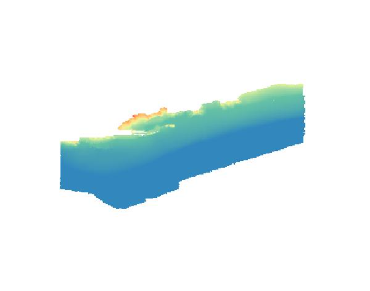
Modelo batimétrico construído com base na informação de sondagem do Instituto Hidrográfico (IH). Ano(s): 2008 Este conjunto de dados integra os Conjuntos de Dados de Elevado Valor/HVD identificados de acordo com o Regulamento de Execução n.º 2023/138 da Diretiva (UE) 2019/1024, relativa aos dados abertos e à reutilização de informações do setor público.
-

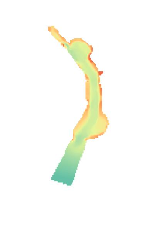
Modelo batimétrico construído com base na informação de sondagem do Instituto Hidrográfico (IH). Ano(s): 2009. Este conjunto de dados integra os Conjuntos de Dados de Elevado Valor/HVD identificados de acordo com o Regulamento de Execução n.º 2023/138 da Diretiva (UE) 2019/1024, relativa aos dados abertos e à reutilização de informações do setor público.
-

Modelo batimétrico construído com base na informação de sondagem do Instituto Hidrográfico (IH). Ano(s): 2012 Este conjunto de dados integra os Conjuntos de Dados de Elevado Valor/HVD identificados de acordo com o Regulamento de Execução n.º 2023/138 da Diretiva (UE) 2019/1024, relativa aos dados abertos e à reutilização de informações do setor público
-
Modelo batimétrico construído com base na informação de sondagem do Instituto Hidrográfico (IH). Ano(s): 2015. Este conjunto de dados integra os Conjuntos de Dados de Elevado Valor/HVD identificados de acordo com o Regulamento de Execução n.º 2023/138 da Diretiva (UE) 2019/1024, relativa aos dados abertos e à reutilização de informações do setor público.
-

Modelo batimétrico construído com base na informação de sondagem do Instituto Hidrográfico (IH). Ano(s): 2005. Este conjunto de dados integra os Conjuntos de Dados de Elevado Valor/HVD identificados de acordo com o Regulamento de Execução n.º 2023/138 da Diretiva (UE) 2019/1024, relativa aos dados abertos e à reutilização de informações do setor público
-

Modelo batimétrico construído com base na informação de sondagem do Instituto Hidrográfico (IH). Ano(s): 2008;2009. Este conjunto de dados integra os Conjuntos de Dados de Elevado Valor/HVD identificados de acordo com o Regulamento de Execução n.º 2023/138 da Diretiva (UE) 2019/1024, relativa aos dados abertos e à reutilização de informações do setor público
-

Modelo batimétrico construído com base na informação de sondagem do Instituto Hidrográfico (IH). Ano(s): 2013 Este conjunto de dados integra os Conjuntos de Dados de Elevado Valor/HVD identificados de acordo com o Regulamento de Execução n.º 2023/138 da Diretiva (UE) 2019/1024, relativa aos dados abertos e à reutilização de informações do setor público
-

Modelo batimétrico construído com base na informação de sondagem do Instituto Hidrográfico (IH). Ano(s): 2014 Este conjunto de dados integra os Conjuntos de Dados de Elevado Valor/HVD identificados de acordo com o Regulamento de Execução n.º 2023/138 da Diretiva (UE) 2019/1024, relativa aos dados abertos e à reutilização de informações do setor público