
Keyword
Geology
13 record(s)
Type of resources
Topics
INSPIRE themes
Keywords
Contact for the resource
Provided by
Representation types
Update frequencies
Scale
-
Manuscript of the geological maps published at scale 1:50 000, and of many surveys of dispersed areas that requires validation before publication.
-
Geological map data of Spain and Portugal at 1:1 000 000 scale modified according to INSPIRE data specifications for the Geology theme. Layers depicting Geologic Units are classified according to ages and lithologies from INSPIRE vocabularies.
-
Geological Map of the Algarve Region, scale 1:100 000, produced by the Geological Survey of Portugal in 1992, as part of systematic geological surveys of the Meso-Cenozoic coast of the Algarve.
-
Prototype of a seamless data model of the Digital Geological Map of Portugal, at scale 1:200 000, in which the mapped units of mainland Portugal were inventoried and organized according to a unified legend (LU). Standardization and harmonization work was carried out between contiguous maps, as well as updating the units through extensive bibliographic research and, above all, leveraging on the experience and knowledge existing at LNEG. The following elements are available: LU code, unit code, unit name, and associated lithological description. This work is under development and reflects the situation as of September 2025.
-
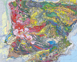
The geological map of Spain and Portugal at 1:1 000 000 scale is a renewed version of the geological map of the Iberian Peninsula and the territories of Ceuta, Melilla and the Balearic, Canaries, Azores and Madeira islands. This small-scale map is edited jointly periodically by the Geological surveys of Spain (IGME) and Portugal (LNEG). This new version includes for the first time the geological information of the Spanish and Portuguese continental shelves and also the geology of the Atlantic Portuguese islands. This map records all the new geological knowledge provided by the complete survey at 1:50 000 scale in Spain (IGME’s MAGNA Plan) and the systematic geological mapping series developed in Portugal by the LNEG. The continental portion of the map was compiled starting from original drafts at 1:400 000 scale made for every main geological unit: Iberian Variscan Massif, Pyrenees, Betics, Cantabrian and Iberian cordilleras and the Duero, Ebro and Tajo Cenozoic basins for the territory of Spain and the geological maps at 1:200 000 scale in Portugal.
-
Geological map data of Portugal at scale 1:1 000 000 modified according to INSPIRE data specifications for the Geology theme. Layers depicting Geologic Units are classified according to ages and lithologies from INSPIRE vocabularies, faults and geomorphologic features are also available. This dataset was formerly prepared in the framework of the OneGeology-Europe project. The faults are harmonized based on the work done within the scope of the HIKE project.
-
Geological Map of Portugal, at scale 1:200 000, composed of the sheets published at this scale (Sheets: 1, 2, 4, 6, 7 and 8).
-
Fifth edition of the Geological Map of Portugal, scale 1:500 000 published by the Geologic Survey of Portugal in 1992.
-
Geological map data of Portugal at scale 1:200 000 modified according to INSPIRE data specifications for the Geology theme. Layers depicting Geologic Units are classified according to ages and lithologies from INSPIRE vocabularies. Sheet 8 has been replaced by the most recent cartography produced within the scope of the Geo_FPI project. Sheet 7 includes the most recent cartography of the Algarve region. It is also intended to prepare the cartography of sheets 3 and 5 as soon as they are published.
-
The Geological Map of Portugal at a scale of 1:1 000 000, published by LNEG in 2010, constitutes the synthesis document of the current knowledge about the geology of mainland Portugal and all insular territory: the Azores and Madeira Archipelagos. This map includes for the first time the geology of the continental shelf around mainland Portugal, drawing on over 30 years of marine geological research. The map comprises: a Geological Map of Mainland Portugal, a Geological Map of the Continental Shelf, and separate geological maps for the Azores and Madeira archipelagos (all at a scale of 1:1 000 000). Additionally, it includes a Neotectonic Scheme of Mainland Portugal with Hypsometry at a scale of 1:4 000 000, a Tectono-Stratigraphic Scheme at 1:5 000 000, and a Location Map at 1:20 000 000.