
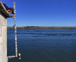
Rede Maregráfica
Este Conjunto de Dados Geográficos (CDG) contém a rede maregráfica internacional, a rede maregráfica nacional e a rede maregráfica nacional da Direção Geral do Território (DGT).
|
|
Citation proposal
(2022) . Rede Maregráfica. https://snig.dgterritorio.gov.pt/rndg/srv/api/records/ef5a6cb7-c9af-432a-b1c2-05b76aa5758f |
Simple
- Date ( Publication )
- 2022-03-01
Resource provider
- Spatial scope ( Theme )
-
- Local
- GEMET - INSPIRE themes, version 1.0 ( Theme )
-
- Características oceanográficas
- Keywords
-
- infoMapAccessService , INSPIRECORE , Rede Maregráfica
- ISO 19119 service taxonomy
-
- InfoFeatureAccessService
- Access constraints
- otherRestrictions Other restrictions
- Use constraints
- otherRestrictions Other restrictions
- Other constraints
- Sem restrições
- Spatial representation type
- vector Vector
- Denominator
- 20000000
- Metadata language
- Portuguese Portuguese
- Topic category
-
- Oceans
- Extent type code
- true
- Geographic identifier
- Local
N
S
E
W
))
- Reference system identifier
- EPSG / 4326
- Distribution format
-
-
WMS
(1.3.0 )
- Specification
-
WFS
(2.0.0 )
- Specification
-
WMS
(1.3.0 )
- Hierarchy level
- dataset Dataset
Conformance result
- Date ( Publication )
- 2010-12-08
- Explanation
- Ver a especificação citada.
- Pass
- false
- Statement
- Os dados de alturas de marés (em metros) são referidos ao nível do Zero hidrográfico.
gmd:MD_Metadata
- File identifier
- ef5a6cb7-c9af-432a-b1c2-05b76aa5758f XML
- Metadata language
- Portuguese Portuguese
- Character set
- utf8 UTF8
- Hierarchy level
- dataset Dataset
- Hierarchy level name
- Conjunto de dados geográficos
- Date stamp
- 2025-11-26
- Metadata standard name
- ISO 19115 Sistema de Metadados dos Açores
Point of contact
Overviews
Provided by

Views
ef5a6cb7-c9af-432a-b1c2-05b76aa5758f
Access to the portal
Read here the full details and access to the data.
Associated resources
Not available