
Boias Spotter
Este Conjunto de Dados Geográficos (CDG) contém a localização geográfica da boia Spotter (mantida pelo Instituto Hidrográfico).
|
|
Citation proposal
(2022) . Boias Spotter. https://snig.dgterritorio.gov.pt/rndg/srv/api/records/a7b4dc24-70e5-4f71-b3e8-af23920bac11 |
INSPIRE
Identification
- File identifier
- a7b4dc24-70e5-4f71-b3e8-af23920bac11 XML
- Hierarchy level
- Dataset
Online resource
Resource identifier
- Metadata language
- Portuguese Portuguese
- Spatial representation type
- Vector
Encoding
- Format
- WMS
- Version
- 1.3.0
- Specification
- Format
- WFS
- Version
- 2.0.0
- Specification
Projection
- code
- 4326
Classification of data and services
- Topic category
-
- Oceans
Classification of data and services
Coupled resource
Coupled resource
Classification of data and services
Coupled resource
Coupled resource
Keywords
- Spatial scope ( Theme )
-
- Local
- GEMET - INSPIRE themes, version 1.0 ( Theme )
-
- Características oceanográficas
- ISO 19119 service taxonomy
-
- infoMapAccessService , InfoFeatureAccessService
Other keywords
- Keywords
-
- infoMapAccessService , INSPIRECORE , Bóias Spotter
Geographic coverage
N
S
E
W
))
Temporal reference
Temporal extent
Temporal extent
- Date ( Publication )
- 2022-03-01
Quality and validity
- Lineage
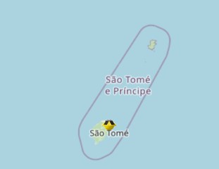
- A boia ondografo Spotter, localizada na costa de São Tomé e Príncipe, permite adquirir dados de agitação marítima e temperatura superficial da água.
- Denominator
- 18000000
Conformity
Conformity
Conformity
Conformity
Conformity
Conformity
Restrictions on access and use
- Access constraints
- Sem restrições
Restrictions on access and use
Responsible organization (s)
Contact for the resource
- Organisation name
- Instituto Hidrográfico
Responsible organization (s)
Contact for the resource
- Organisation name
- Instituto Hidrográfico
Metadata information
Contact for the metadata
- Organisation name
- Instituto Hidrográfico
- Date stamp
- 2025-11-27T14:56:26
- Metadata language
- Portuguese Portuguese
- Character set
- UTF8
SDS
Conformance class 1: invocable
Access Point URL
Endpoint URL
Technical specification
Conformance class 2: interoperable
Coordinate reference system
Quality of Service
Access constraints
Limitation
Use constraints
Limitation
Responsible custodian
Contact for the resource
Conformance class 3: harmonized
Overviews
Provided by

Views
a7b4dc24-70e5-4f71-b3e8-af23920bac11
Access to the portal
Read here the full details and access to the data.
Associated resources
Not available