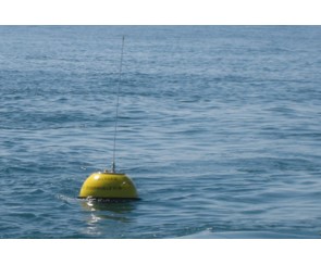
Boias Datawell Waverider
Este Conjunto de Dados Geográficos (CDG) contém as posições geográficas das boias Datawell Waverider (https://datawell.nl/). Estas boias registam vários parâmetros oceanográficos, nomeadamente agitação marítima e temperatura da água do mar.
Estas boias são geridas pelo Instituto Hidrográfico (https://www.hidrografico.pt/), Administração dos Portos da Região Autónoma da Madeira (https://apram.pt/) e Associação para o Estudo do Ambiente Insular (https://climaat.angra.uac.pt/boias/).
Este conjunto de dados integra os Conjuntos de Dados de Elevado Valor/HVD identificados de acordo com o Regulamento de Execução n.º 2023/138 da Diretiva (UE) 2019/1024, relativa aos dados abertos e à reutilização de informações do setor público.
|
|
Citation proposal
(2022) . Boias Datawell Waverider. https://snig.dgterritorio.gov.pt/rndg/srv/api/records/0205ed82-a085-4432-98f5-ff0326c4d4de |
Simple
- Date ( Publication )
- 2022-03-01
- Credit
- https://www.hidrografico.pt/
- Credit
- https://apram.pt/
Point of contact
- Maintenance and update frequency
- As needed
- GEMET - INSPIRE themes, version 1.0 ( Theme )
-
- Características oceanográficas
- Spatial scope ( Theme )
-
- Nacional
- Keywords
-
- INSPIRECORE , Boias Datawell Waverider , infoMapAccessService , InfoFeatureAccessService , HVD , NODC-PT , Observação da Terra e do ambiente
- Access constraints
- Other restrictions
- Use constraints
- Other restrictions
- Other constraints
- Sem restrições. Licença de utilização - CC-BY-4.0 (https://creativecommons.org/licenses/by/4.0/)
- Spatial representation type
- Vector
- Denominator
- 10000000
- Metadata language
- Portuguese Portuguese
- Character set
- UTF8
- Topic category
-
- Oceans
))
- Reference system identifier
- EPSG / 4326
- Distribution format
-
-
WFS
(2.0.0 )
- Specification
-
WMS
(1.3.0 )
- Specification
-
OGC API - Features
(API - Features )
- Specification
-
WFS
(2.0.0 )
Point of contact
- OnLine resource
- https://webgeo4.hidrografico.pt/geoserver/oceanography/buoys_datawell/ows?service=WMS&version=1.3.0&request=GetCapabilities
- OnLine resource
- https://webgeo4.hidrografico.pt/geoserver/oceanography/buoys_datawell/ows?service=WFS&version=2.0.0&request=GetCapabilities
- OnLine resource
- https://api-features.hidrografico.pt/collections/buoys_datawell
- Hierarchy level
- Dataset
Conformance result
- Date ( Publication )
- 2010-12-08
- Explanation
- Ver a especificação citada.
- Pass
- false
- Statement
- As boias ondógrafo, existentes na plataforma continental, são dotadas de sensores que permitem adquirir dados de agitação marítima e temperatura superficial da água.
gmd:MD_Metadata
- File identifier
- 0205ed82-a085-4432-98f5-ff0326c4d4de XML
- Metadata language
- Portuguese Portuguese
- Character set
- UTF8
- Hierarchy level
- Dataset
- Hierarchy level name
- Conjunto de dados geográficos
- Date stamp
- 2025-11-24T11:14:30
- Metadata standard name
- ISO 19115 Sistema de Metadados dos Açores
Point of contact
Overviews

Provided by

